
Bellevue ZIP Directory Coverage
Seven ZIPs commonly serve Bellevue postal addresses. Five are regular delivery areas associated with broad parts of the city, while two chiefly serve post-office-box or central postal needs. Neighborhood names below are practical search labels, not legal boundaries. Downtown and Meydenbauer Bay commonly point toward 98004, for example, while Lake Hills and Phantom Lake commonly point toward 98008. An exact address still needs Postal Service validation.
| ZIP Code | Areas Covered | Post Office | Notes |
|---|---|---|---|
| 98004 | Downtown, West Bellevue, Meydenbauer Bay, central waterfront | Bellevue | Regular delivery area; city and postal edges differ |
| 98005 | BelRed, Wilburton, parts of Northeast Bellevue | Bellevue | Mixed industrial, office, and residential area |
| 98006 | Eastgate, Factoria, Somerset, Newport, South Bellevue, Cougar Mountain approaches | Bellevue | Community, city, and county labels may differ |
| 98007 | Crossroads, Bridle Trails, Northeast Bellevue | Bellevue | Broader than any single neighborhood |
| 98008 | Lake Hills, West Lake Sammamish, Phantom Lake, eastern Bellevue | Bellevue | Verify the exact city jurisdiction |
| 98009 | Post-office and PO Box service | Bellevue | Not a dependable street-residence key |
| 98015 | PO Box and central postal service | Bellevue | Street coverage is limited or specialized |
The surrounding postal map also labels Medina, Mercer Island, Redmond, Renton, and the Issaquah and Newcastle area with nearby ZIPs. That context matters at Bellevue's edge. A parcel may be described by a familiar Bellevue community name yet route mail through another postal convention. Conversely, a Bellevue mailing line is not conclusive proof that the land lies inside city limits.
When a name search returns several Bellevue addresses, sort them by exact five-digit ZIP only after checking the date on each record. A former mailing address may remain on an older deed, directory, or tax document after a move. Current USPS formatting cannot retroactively settle what a dated source meant. Preserve the address as printed, then add the present standardized version as a separate research note.
Bellevue ZIP Neighborhood Pairs
The western and central ZIPs reflect distinct records vocabularies. Search 98004 with Downtown, West Bellevue, Meydenbauer Bay, and waterfront terms. For 98005, add BelRed and Wilburton. Permit and land-use records are especially useful in those redevelopment areas because a project address, applicant, owner, and status can place a dated name at a site.
South and east Bellevue require wider term sets. Use Eastgate, Factoria, Somerset, Newport, and Cougar Mountain with 98006. Crossroads and Bridle Trails commonly appear with 98007. Lake Hills, Phantom Lake, and West Lake Sammamish are strong companion terms for 98008. These pairings help locate a likely parcel or newspaper item, but only the exact address resolves the ZIP.
Note: A neighborhood label narrows research; it never replaces an address-level postal or parcel check.
Search Bellevue Residents by ZIP
No single official portal produces a casual roll of everyone within a Bellevue ZIP code. The USPS ZIP Code Lookup validates delivery formatting. The King County Parcel Viewer accepts an address, parcel number, or condominium name, but it has no documented ZIP-wide search. The assessor card is likewise parcel based. Washington Unclaimed Property accepts city and ZIP fields, though a result only shows an association with unclaimed property, not current residence.
The voter routes also need careful separation. VoteWA is an individual check based on a name and date of birth, not a ZIP browser. The Washington voter database extract is a controlled file-request channel with statutory fields and use limits. A researcher working with a lawfully obtained file should keep its month, county selection, and ZIP field with every conclusion. Protected voter data and confidential identifiers do not become available through either route.
- Enter the complete street address in USPS lookup and save the standardized postal city and ZIP.
- Search that address in Parcel Viewer, record the parcel ID and jurisdiction, then open the linked eReal card.
- Compare the site's physical, or situs, address with the owner's mailing address. They may be different.
- Use permit records by address and older directories by the street and community name. Use voter data only through its lawful person or controlled-file route.
Once the postal area is narrowed, the Bellevue street directory carries the search along a named street. That handoff is important because county property systems do not expose a documented citywide ZIP filter. Work from exact addresses and mapped parcels rather than assuming every record with the same postal code belongs to one neighborhood.
Verify Bellevue ZIP Results
The official USPS lookup offers address mode and city-and-state mode. It confirms postal delivery data, not land ownership or Bellevue jurisdiction.
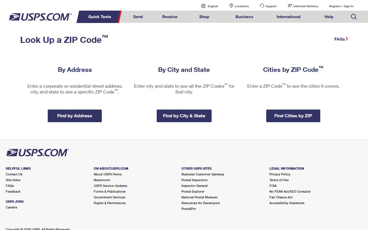
The captured screen shows why the full street line belongs at the start of a ZIP search. Carry its result into county GIS instead of reading the postal answer as a city-boundary ruling.
Bellevue ZIP Address Keys
Five address forms may appear in one Bellevue search. The situs address locates the parcel. The mailing address receives tax notices and may point to a different city, agent, or post-office box. A legal description identifies land through a plat, lot, block, unit, or survey language. A directory address preserves the printed wording of its year. Voter residence is a regulated registration field.
| Situs | The physical property location used by assessor, GIS, and permit records |
|---|---|
| Mailing | The correspondence destination shown for an owner |
| Legal | The deed and plat key that can survive a changed street label |
| Directory | The address as printed in a dated historical source |
| Postal | The current delivery convention validated by USPS |
Keep each field in its own note. Combining them can turn an out-of-town mailing address into a false claim about where an owner lives, or cause a valid older directory entry to be rejected because its street wording changed.
A Bellevue permit adds another dated address form. The city's public search exposes a keyword and category control, while older or more complete files go through Development Services records. Permit names show project roles, such as applicant or owner, rather than a complete list of residents. Match the project address to the parcel before carrying any name into the ZIP code directory.
Bellevue PO Box ZIPs
ZIPs 98009 and 98015 carry post-office-box or central-service context. They are useful for routing mail and identifying a correspondence address, but they do not map a household to a street parcel. A PO Box can belong to a person, an estate, or an organization while revealing nothing about physical location.
Key distinction. A Bellevue PO Box ZIP is a mailing lead, never proof of a street residence or parcel.
If one appears on a deed, assessor card, or directory entry, retain it as the mailing field. Find the situs address through the parcel ID or legal description. This keeps 98009 and 98015 from being mistaken for ordinary neighborhood rolls.
Bellevue ZIP History Labels
Annexation explains many address conflicts in the Bellevue ZIP code directory. Bellevue incorporated in 1953, but familiar communities joined the city in stages. Crossroads entered in 1964, Lake Hills in 1969, Factoria in 1993, and Coal Creek in 2009. Eastgate and Tamara Hill, Horizon View, and Hilltop followed in 2012. Bellevue reported that the 2012 changes alone added more than 5,400 residents, roughly 1,850 residences, and 700 acres.
A source created before annexation may file an address under King County while a later record uses Bellevue. Postal usage can also adopt Bellevue before city government does. Preserve the year, community name, ZIP, and jurisdiction shown on each source. Then compare the same parcel through its legal description rather than forcing every record into today's city label.
This method is especially useful around Eastgate, Crossroads, Lake Hills, and Factoria. It also explains why a search limited to the modern municipal name may miss a valid directory, deed, permit, or newspaper reference. The postal code narrows the area; annexation history restores the proper time context.
Bellevue ZIPs Versus City Limits
ZIP codes route mail. They do not establish Bellevue's legal boundary. The 1953 city later expanded through Crossroads in 1964, Lake Hills in 1969, Factoria in 1993, Coal Creek in 2009, and several Eastgate-area annexations in 2012. A historical source can therefore use Bellevue as a postal or community label before the parcel joined the city.
Pair four findings: USPS delivery data, the Bellevue city-limit layer, King County parcel jurisdiction, and the historical neighborhood or annexation name. A mismatch is evidence about how the address was described, not an error to erase. For land records, the parcel ID and legal description provide the best continuity.
- ZIP code
- A five-digit postal routing area that may cross municipal boundaries.
- ZIP+4
- A more precise delivery segment appended to the five-digit ZIP.
- PO-box ZIP
- A code mainly associated with boxes or central postal service rather than a residential street area.
- Carrier route
- A mail-delivery path within a ZIP, not a public roll of its residents.
The Bellevue ZIP code directory is therefore a sorting tool. Confirm people through dated, official records and confirm property through county parcel and recorded instruments.