
Bellevue Neighbor Record Sources
Different public sources answer different block questions. The parcel map shows shapes and nearby site addresses. The assessor ties each selected parcel to an owner, mailing address, legal description, and building facts. Recorded deeds explain transfers and shared easements. City permit files can date construction and land-use work. None is a complete household census, so describe results as records associated with parcels.
| Source | What It Shows About a Block | Access |
|---|---|---|
| King County Parcel Viewer | Adjacent parcel shapes, address points, summaries, zoning and district context | Free map with click, select, and export tools |
| King County eReal | Owner, mailing and situs addresses, legal description, building facts | Free individual parcel cards |
| Landmark deeds and plats | Transfers, easements, lot and block relationships | Free index; image access varies by date |
| Washington voter records | Lawfully supplied address, precinct, and district fields | Individual VoteWA check or controlled file request |
| Bellevue neighborhood groups | Public civic contacts, areas, meeting and communication details | City-recognized association list |
| KCLS directories and papers | Past occupants, businesses, notices, deaths, and street context | Library, microfilm, or reference help |
An owner may receive mail elsewhere, and a resident may own no land. Compare the situs address with the mailing address, preserve the source date, and avoid turning an ownership lead into a statement about current occupancy. That distinction is central when identifying Bellevue neighbors.
City permits and code records add a site-specific layer. A permit can identify a project address, applicant, owner, contractor, designer, or land-use action, subject to redaction. Those roles document work at the site and do not prove residence. Use the public keyword search first, then request the complete or older file from Bellevue Development Services when the indexed result lacks needed context.
Bellevue Neighborhood Association Areas
The City of Bellevue recognized association list organizes groups across 16 areas, including BelRed, Bridle Trails, Cougar Mountain and Lakemont, Crossroads, Downtown, Eastgate, Factoria, Lake Hills, Newport, Northeast and Northwest Bellevue, Somerset, West Bellevue, West Lake Sammamish, Wilburton, and Woodridge.
Named groups include Downtown Bellevue Residents Association, Eastgate Community Association, Lake Hills Neighborhood Association, Newport Hills Community Club, Phantom Lake HOA, Wilburton Community Association, and Woodridge Community Association. Public contacts help interpret local geography and civic activity. They are not proof that any person belongs to a group.
The city's update form records group name, area, membership size, officers, email, phone, website, communication methods, meeting frequency, and speaker interest. It does not promise public member directories. Use association contacts for public civic questions, never to seek a private roster.
Contact neighborhood outreach at neighborhoodoutreach@bellevuewa.gov when the recognized-group page needs clarification. A public officer or website can confirm which civic group serves an area, but association lines may not match parcel, postal, school, or voting boundaries. Record the type and date of every boundary instead of treating them as interchangeable.
See Bellevue Community Geography
The official neighborhood-association page is the source for recognized areas and current public group information.
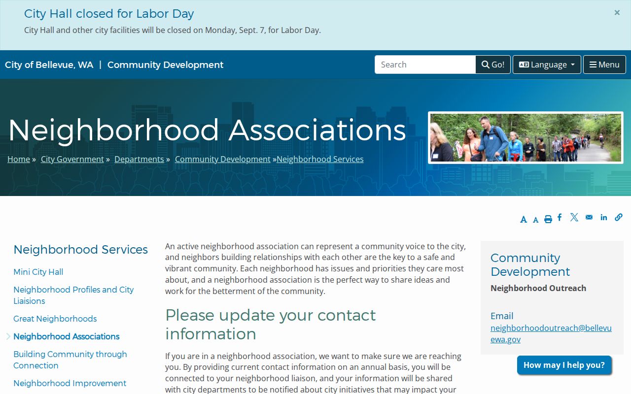
The captured city page provides a civic layer alongside parcel geography. It helps name the community around a block without claiming access to private household lists.
Map a Bellevue Neighbor Block
Use the King County Parcel Viewer to turn one address into a defined block. Search by address, parcel number, or condominium name. Zoom until adjacent boundaries are clear. The map can select several parcels and export chosen data, but it is an informational research tool, not a survey or an official neighbor list.
- Locate the target address and note the highlighted parcel, map orientation, and access streets.
- Click each touching parcel and record its parcel ID, situs address, and legal description.
- Open each linked eReal card. Compare owner and mailing fields, building details, and the date of the record.
- Use Landmark only when a transfer, easement, plat, or shared access question needs recorded evidence.
Draw a small, consistent boundary for the block and timestamp the work. Owners can change while parcel shapes and association areas remain. For a full named road instead of the immediate radius, use the Bellevue street directory.
King County iMap can add political boundaries, planning and natural-resource layers, roads, aerial images, landmarks, and intersection searches. These layers help explain why two nearby parcels may have different district or development contexts. They still do not identify occupants. Save the layer names and map date so another researcher can repeat the same block view.
Bellevue Plats Explain Blocks
Parcel lines alone do not explain every relationship between Bellevue neighbors. A plat establishes recorded lots and blocks. A condominium declaration identifies units and common areas. Easements can document access, utilities, or other rights across nearby land. The King County Landmark index searches these recorded instruments.
- Parcel
- A mapped unit used for tax and land administration.
- Plat
- A recorded plan dividing land into lots, blocks, streets, or tracts.
- Easement
- A recorded right to use part of another parcel for a stated purpose.
- Situs address
- The physical site address, distinct from an owner's mailing address.
Most recorded-document images from August 1, 1991 forward are online. Older material may require King County Archives and a name, date range, recording number, or legal description. Never treat the map line alone as a ruling on ownership or legal access.
Bellevue Block Voter Limits
VoteWA checks one registration using first name, last name, and date of birth. It does not publish a casual street-wide search. The separate state voter database process may provide statutory address and precinct fields for lawful use, but RCW 29A.08.720 restricts advertising and solicitation, and protected information remains withheld.
A voter match is dated evidence tied to registration. It does not show every person at an address or reveal how anyone voted. A non-match may reflect a prior address, spelling difference, inactive status, lag, or protected status. Do not publish a downloaded file as a block directory.
Privacy first. Record only the public facts needed for a lawful purpose, and never try to defeat a protected address.
Trace Earlier Bellevue Neighbors
Historical neighbors require dated sources. Bellevue-area directories are confirmed in 1964-65, 1966, 1972, and 1982 catalog traces, though the exact coverage of each volume must be checked. Address-oriented or reverse sections can place a surname or business on a block. The Bellevue Library microfilm inventory then adds notices, advertisements, deaths, meetings, and moves.
The Bellevue American runs from 1935 to 1976. Daily Journal-American coverage spans 1976 to 1996 with listed gaps, and Eastside Journal runs from 1996 to 2003 with a February 2001 gap. A missing notice during a documented gap is not proof that an event did not occur.
Crossroads, Lake Hills, Factoria, BelRed, Wilburton, Newport, and Phantom Lake reflect different development eras and record vocabularies. Keep the modern street address, postal city and ZIP, and historical community name together. That protects against false misses caused by annexation or changing local labels.
The city's annexation history is a practical search key. Crossroads joined Bellevue in 1964, Lake Hills in 1969, Factoria in 1993, Coal Creek in 2009, and Eastgate-area communities in 2012. Earlier directories or county files may use a community or county label where a current parcel uses Bellevue. Follow the legal description and dated address rather than rejecting the older result.
Bellevue Neighbor Source Choices
Official rolls and compiled commercial tools answer different questions. County and city records identify their custodian, field meanings, and dates. Commercial products may merge old addresses and household guesses without showing how a match was made.
| Source type | Strength | Limit |
|---|---|---|
| Official parcel and deed records | Dated ownership, legal descriptions, and recorded instruments | Not a household list |
| City association records | Public civic geography and group contacts | No promised private roster |
| Historical directories and papers | Dated names, addresses, and community context | Coverage and gaps vary |
| Commercial compilations | May combine many leads | Freshness, accuracy, and source logic may be unclear |
Prefer the official source for any fact that matters. Use a second dated source before describing who appears to be associated with a Bellevue address today.
Protect Bellevue Neighbors' Privacy
Renters and household members may not appear in property records. Utility customers, delivery data, full dates of birth, government ID numbers, and protected voter information are not a public block directory. Washington's Address Confidentiality Program gives eligible people a substitute address and protects the link to their actual residence.
Search failure may reflect a safety protection, not missing data. Do not ask a protected person to reveal the relationship between a substitute and actual address. Contact public association representatives only through published channels, and respect that board listings do not identify every nearby household.
Lawful use. Bellevue neighbor records may support civic curiosity, family history, reconnection, or personal safety. Never use them to watch, harass, intimidate, or harm another person.